Ever wondered how successful entrepreneurs turn their dreams into reality? What drives them to push the envelope, create change and advance their industries? Canadian small business owners share how they transformed their ideas, goals and passions into reality.
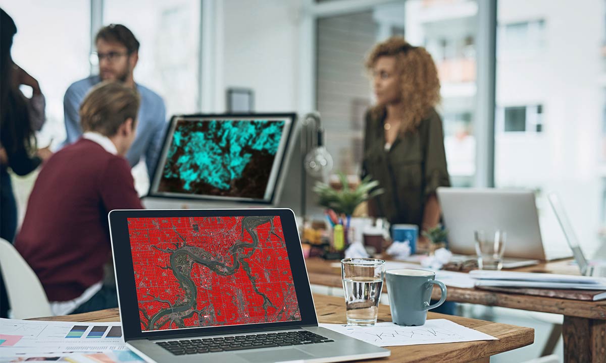
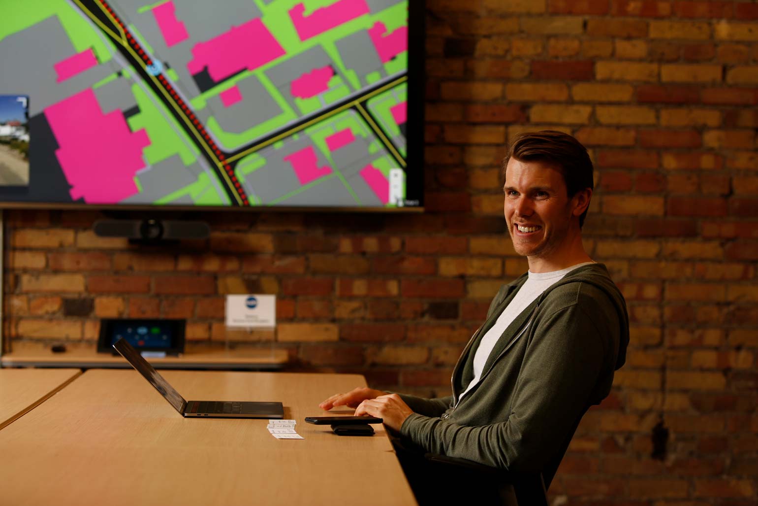
Recently named one of Canada’s fastest growing companies, Ecopia.AI (Ecopia) is solving problems that have never been solved before. Leveraging Artificial Intelligence (AI) to mine geospatial big data, they are creating an up-to-date, highly accurate digital representation of the earth that is being used by decision-makers around the world. Ecopia is producing millions of kilometres worth of commercial-grade high-definition maps of the earth every month, empowering organizations the make better data-driven decisions.
Ecopia Co-Founder and President Jon Lipinski shares more about the company, their groundbreaking technology, and exciting plans for the future, including the creation of the first comprehensive digital map of Sub-Saharan Africa, which stands to positively affect the lives of hundreds of millions.
Q: How was Ecopia formed?
Lipinski: Ecopia began as one of the co-founder’s PhD research at the University of Waterloo. Yuanming Shu, our CEO and inventor of the core technology, was pursuing his PhD in relation to the question of: how can AI be applied to teach a computer to interpret geospatial imagery like a human? For example, leveraging AI to analyze satellite imagery to detect and outline different objects such as houses and roads.
During his PhD, Yuanming received an offer from a large company to purchase the technology he had developed. Instead, in 2013, he decided to start working with his friend, Shuo Tan — a Master’s student at the University of Waterloo, to see if and how they could create a company around this technology.
That’s about when they met me — I was a recent graduate of Ivey Business School at the University of Western Ontario, and was looking to become part of something exciting and meaningful.
Recognizing that there was government grant funding available, the three of us came together to write a proposal. We were successful and received a small amount of funding, which we leveraged to pursue the commercialization of the technology – and in February of 2013 we incorporated Ecopia.
Q: Can you explain the product? What is Ecopia?
Lipinski: We provide high definition maps to enterprise map users — across industries such as insurance, government, telecommunications, and NGOs — who need highly accurate and up-to-date maps to make important decisions about things such as assessing the risk of insuring a home, urban planning, planning and deploying telecommunications infrastructure, and planning solar installations. These maps are created by leveraging AI-based systems to mine geospatial imagery (ie. imagery from a satellite, airplane, street-view car, etc.).
Ecopia’s mission is to digitize the world using AI — to create a digital representation of reality that offers unique insight for decision-making at-scale.
Q: With such a specialized product, how have you built your business?
Lipinski: There is an inadequate amount of accurate, up-to-date information of the earth. Current sources (including consumer-facing maps) do not provide adequate solutions for enterprise analysis and decision-making – resulting in a massive information gap for critical decision-makers around the world. There are obvious applications such as navigation and logistics, yet many uses of maps might not be obvious at a surface level. For example, getting a quote for home insurance, using a cell-phone on a 5G network, or even the efficiency of your municipal storm-water drainage system are all applications that have some form of underpinnings in map technology.
We landed our first big deal in 2016 – a contract to map all the buildings in Australia for the federal government there. At the time there was no other database of this kind, yet there was a strong need across many different industries.. We partnered with a satellite company, DigitalGlobe (now Maxar Technologies) to capture satellite imagery of the entire continent, and then leveraged our AI-based processes to mine that imagery and generate a map of each and every building across Australia – it was 16 million buildings over 7.69 million km2. The process took 6 months.
Based on the success of that project, in 2018 we further endeavored to create a map of all buildings in the contiguous U.S. — 169 million buildings across 8 million km2. And, although the US contains 10x the number of buildings as Australia, we completed the map in the same 6-month time-frame, which really speaks to the scaling nature of the technology. This map is now being used by clients including various governments, insurance companies, and telecommunications providers.
Further, just a few weeks ago, we announced an exciting initiative to create the first comprehensive digital map of all buildings, roads and forests across Sub-Saharan Africa. This project was co-funded by SDTC (Sustainable Development Technology Canada) and the Government of Canada, who contributed a $6.7M investment.
In addition to these initiatives, Ecopia has completed hundreds of customer engagements around the world, amassing a powerful and growing database of commercial-grade map content. We’ve managed to double our business every year since its inception, and have no plans of slowing down.
Q: What is the scope of the Sub-Saharan Africa project?
Lipinski: Until now, Sub-Saharan Africa has been operating without consistent access to accurate information about their geographies, resulting in inefficiencies and inaccuracies in decision-making across the continent.
With funding from SDTC, we are developing the first comprehensive map of Sub-Saharan Africa, which will include an estimated 342 buildings, 3.8 million linear kilometres of roads, and 582 million hectares of forests. This data will empower governments, NGOs, and businesses to optimize their efforts on the ground including use cases such as vaccine distribution, sustainable infrastructure deployments, and even the monitoring and policing of deforestation.
Q: How have you funded the business and product development?
We are primarily bootstrapped — we raised a small angel round five years ago but that’s about it. Luckily, we have been able to leverage a great ecosystem of government funding sources and are very thankful to be in a country that promotes tech development and start-ups as much as Canada does.
We’ve had many supporters along the way including the Ontario Centres of Excellence, IRAP (Industrial Research Assistance Program), FedDev, TECTERRA, Communitech, and SDTC (Sustainable Development Technology Canada).
And of course institutions like RBC and BDC have supported us since day one — they understand how to work with tech companies versus traditional asset-based lending models. We have a lot of intrinsic value, but not assets – it’s a new concept, but I think RBC and BDC are doing a great job of wrapping their heads around that.
Q: What do you look for when you hire?
One of the big things that we look for is fit with our organization. We’re a close-knit team — everyone works very closely together, and we need to find team members that align with our culture.
We really try to find and develop an entrepreneurial spirit — full accountability and responsibility for not only personal success, but the success of the team as whole. We have a big results-driven culture — we work really hard together, and also celebrate successes in a big way together.
Q: How do you attract bright tech minds with so much competition in Canada and across the border?
Lipinski: At bigger companies you can get lost in the mix and never really see the impact of your hard work. Meanwhile at Ecopia, everyone is encouraged to take an increasing amount of responsibility, and the work being done often has a direct and immediate impact on the business.
Another big draw is the type of work that we’re doing. We’re not only solving very difficult technology problems, but the results of our work are having a meaningful impact on the lives of people around the world – it’s really fulfilling to be a part of. With our work on Sub-Saharan Africa for instance, our maps are being used to distribute vaccines in an effort to eradicate disease (people are still dying from diseases that have been eradicated in developed nations), and to build infrastructure to provide power across the continent (600M people across sub-Saharan Africa do not have stable access to electricity).
Q: What’s next for Ecopia?
Lipinski: Part of our vision is to serve emerging industries that require high-accuracy mapping products such as autonomous vehicles and augmented reality. We’re actually doing work around autonomous vehicles right now – as a partner in the Autonomous Vehicle Innovation Network, we are creating the first high-definition map of the Region of Waterloo for use in autonomous vehicles.
We have aggressive plans for international expansion and product-line growth. There is a ton of opportunity in this space, and the markets are boundless – we’re constantly finding new applications of our maps.We feel we’re very uniquely positioned to lead the market, and are actively hiring to expand the team and execute on our vision.
This article is intended as general information only and is not to be relied upon as constituting legal, financial or other professional advice. A professional advisor should be consulted regarding your specific situation. Information presented is believed to be factual and up-to-date but we do not guarantee its accuracy and it should not be regarded as a complete analysis of the subjects discussed. All expressions of opinion reflect the judgment of the authors as of the date of publication and are subject to change. No endorsement of any third parties or their advice, opinions, information, products or services is expressly given or implied by Royal Bank of Canada or any of its affiliates.